| Your cart is currently empty |
| Subtotal: | $0.00 |
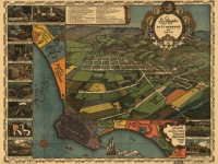
Explore America through antique maps. We offer a large number of map collections on CD which are sure to tickle every map enthusiast. Maps from the 14th century to the 19th century are included in the collections. These historic maps can often be very helpful for Treasure Hunters, when trying to locate places which no longer appear on current maps.
All maps are in MrSid format, which allows you to see the entire map on your computer screen or drill down to see the smallest details. This format The original maps are often quite large, as much as 36" long or larger and very detailed. With the MrSID software, you can manipulate the map to print the entire map in great detail or zoom into a portion of the map in full detail for viewing or printing. MrSID software is included on the CD.
Made in the USA.


 - 2oz")